

WILD BOAR are causing more and more damage to agricultural land in Europe, requiring hundreds of thousands of euros in compensation – and prompting the creation of a new drone-based method to estimate crop damage in a fast and objective manner.
Presenting the method at the ‘Ecology Across Borders’ conference in Ghent, Belgium, Antwerp PhD student Anneleen Rutten explained how it uses a standard commercial drone to take aerial photographs of agricultural fields, which are analysed with an algorithm to identify the damaged areas.
Rising numbers of wild boar have been linked to higher crop damage, disease transmissions and car accidents in many European countries. In Flanders, wild boars have been absent for almost 50 years and only returned in 2006. Estimates from hunting bags show a growing population which is still expanding its range, from the eastern province of Limburg towards the more central provinces of Antwerp and Vlaams-Brabant.
Landscape structures in Flanders changed in the years of absence of wild boar, resulting in a dense, mosaic-like pattern of agricultural, natural and urban areas. Thus, there have been many human-wildlife conflicts since.
“I want to get a first insight into the extent of agricultural damage by wild boar because, in contrast to neighbouring regions and countries, this has not been monitored in the past and it is not known how high the financial damages are for this sector," said Ms Rutten.
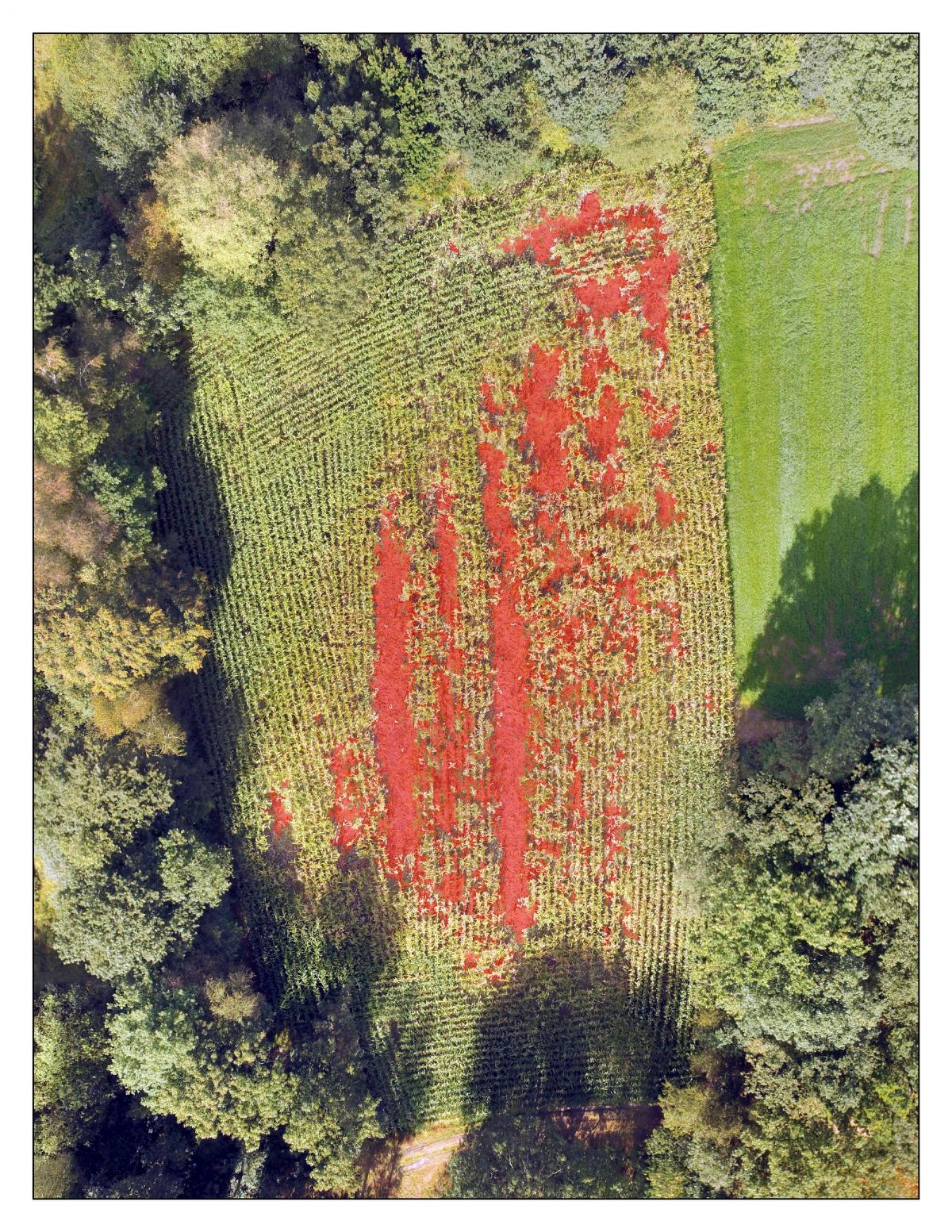
Her method was developed to be affordable and easy to apply: “I connect my smartphone to the remote controller of my drone which allows me to see the camera visualisation. Damage is really clear on the camera – in maize fields, boars roll over the maize which results in gaping holes with broken stems in an otherwise green field. In grasslands, rooting causes a clear colour difference because the soil is rooted up," she said.
For each field, many individual photographs with a 75-85% overlap are taken, which enables combination of individual photographs into a single image, taking account of different perspectives and showing the entire field. The area of the field is then classified into damaged and undamaged parts using Object Based Image Analysis, an algorithm which reaches 93% of accuracy for maize fields and 94% for grasslands.
Traditionally, crop damage is estimated by trained experts measuring the damaged area in the field, but flying and taking photographs of damaged fields does not take as long, and is more cost-effective. Another advantage is that the method is standardised, allowing for direct comparisons between different fields and over time.


Comments: Our rules
We want our comments to be a lively and valuable part of our community - a place where readers can debate and engage with the most important local issues. The ability to comment on our stories is a privilege, not a right, however, and that privilege may be withdrawn if it is abused or misused.
Please report any comments that break our rules.
Read the rules here