

A new method to measure soil nutrients – recording gamma radiation – looks set to revolutionise the standard in accuracy in precision farming thereby providing the potential for increased crop yields.
TerraMap was launched by crop protection specialists Hutchinsons, at last week’s highly successful Arable Scotland Event just outside Dundee and aims to take UK production to a new level by measuring soil texture, type, elements, minerals, organic matter and other key properties.
According to the company’s precision technology manager, Oliver Wood, current precision farming requirements demand greater accuracy and the high definition soil scanning system from Hutchinsons aims to deliver just that.
TerraMap uses gamma-ray detection technology that delivers resolutions of more than 800 points/ha, providing high definition mapping of all common nutrient properties to include pH, soil texture, organic matter and CEC as well as elevation and plant available water.
“With such a growing level of interest in soils, the launch of TerraMap comes at the perfect timing for farmers who are looking for that next level of accuracy in understanding their soils – which has not previously been possible,” he said.
“We have been looking for a new method of mapping soils that provides more accurate and repeatable results, and can also leverage the multi-layer analysis within Omnia,” added Mr Wood.
The results from TerraMap are used to create maps within the Hutchinsons Omnia system which can then be overlaid with additional field information such as black-grass, yields and so on, to create more accurate, consistent and detailed variable rate plans.
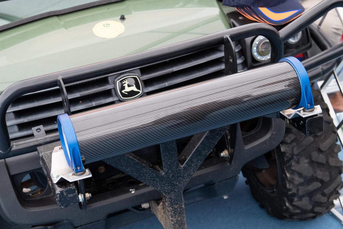
The infield process of collecting the data is carried out in two simple steps – scanning by driving a light weight all terrain vehicle fitted with the sensor over a field, and then taking soil samples to allow for each scan to be used to create the individual map layers.
Manufactured by Canadian company SoilOptix, TerraMap’s scanning technology is based on a scaled-down version of airborne sensors that originates in mineral prospecting, and has been used in other countries successfully.
It measures naturally emitted isotopes, like Caesium and Potassium, that are stable due to their long half-lives.
“It’s an entirely passive sensor, with the significance of this methodology being that it is not affected by soil moisture, compaction, crop cover or cultivation state.
“This means that there are very few limitations to when TerraMap can be used – offering a much wider operating window compared to other soil scanning systems.”
Furthermore, Mr Wood said the consistency and reliability of the results are proven, with yield increases up 0.6t per hectare shown in previous years and potential for further increases.
“We have taken satellite imagery of fields that showed up areas of soil differences quite clearly and when we overlaid this with the texture maps created by TerraMap they were identical. This has been confirmed by in-field ground truthing across a number of sites.”
“We have also tested the results between seasons and over different cultivations, and they have remained consistent.”
It was on this basis that Thurlow Estates manager, Andrew Crossley trialled TerraMap. “We had used another scanning service back in 2012 and it threw up some questionable results, which we put down to interference to the scanning from the chalky soils and changes in soil structure, but nothing was conclusive.”
He added that when he was introduced to the TerraMap system, he felt that it would work well with his soil types, with the results being impressive and are more accurate than previous results.
“We look forward to seeing how this will integrate this autumn with our precision farming to give us more accurate variable rate plans, especially on our chalky soils.”
TerraMap is available from Hutchinsons in a standard or premium service offer. The standard service, priced at a one off payment of £24 per ha measures nine criteria: P, K, Mg, pH and % of clay, sand, silt, texture and elevation. In addition to these, the premium service also measures calcium, manganese, boron, copper, molybdenum, iron, zinc, sulphur, OM, CEC and plant available water, delivering 21 layers of data for each field and is priced at £32 per ha.
The launch of TerraMap reflects the continued investment and subsequent development of tools offered within the Omnia Precision Agronomy system. Since its launch in 2016, Omnia has developed drone imagery mapping, the Connect system, cost of production and yield mapping. Omnia now has over 620 UK users covering 375,000 hectares. To find out more about TerraMap contact the Omnia Services Centre on 01526 831000.


Comments: Our rules
We want our comments to be a lively and valuable part of our community - a place where readers can debate and engage with the most important local issues. The ability to comment on our stories is a privilege, not a right, however, and that privilege may be withdrawn if it is abused or misused.
Please report any comments that break our rules.
Read the rules hereComments are closed on this article