

A NEW British-based business is making great headway with its award winning onTrak GPS steering guide which is aimed at keeping tractor drivers on the straight and narrow for precision farming at very low cost.
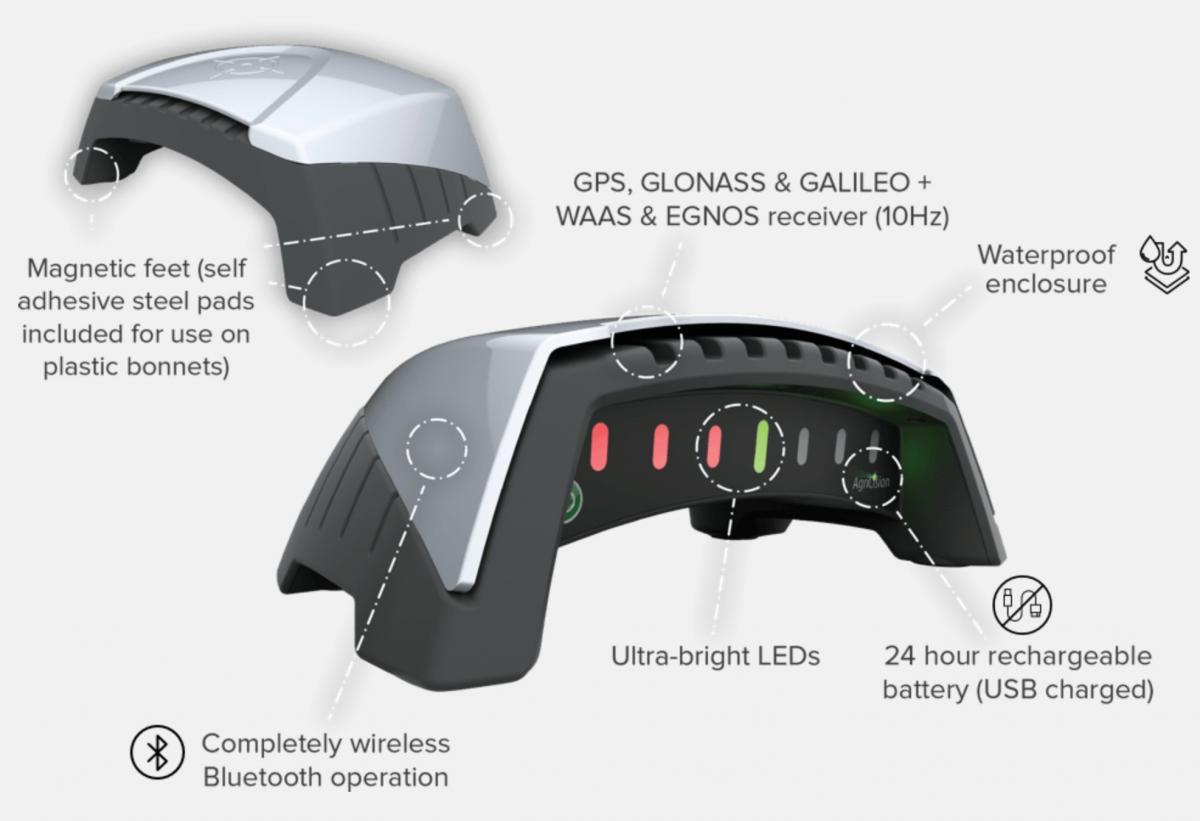
Thought to be a market leading entry level GPS system, it is produced entirely in the UK by Agricision and costs £675 plus VAT to kit your tractor out for straight-line and bout work, with the added advantage of the system being easily moved from one tractor to another.
With fertiliser prices heading for £1000 per tonne and red diesel at £1.50-plus per litre, using inputs efficiently is potentially more important than ever. For fertiliser spreading on grassland, farmers without GPS often attempt to judge a 12m, 18, or even 24m spread width by eye alone, which can lead to over or under spreading, pointed out Agricision MD, Adam Keene. Likewise with sprayers when not working in tramlines.
Being app based, this system has the advantages of using smartphones and tablets you already own, which keeps costs low and any updates to both the firmware inside the onTrak receiver/lightbar and to the app itself are delivered automatically and remotely, said Mr Keene. For more advanced users, cloud connectivity can be leveraged to keep track of farm operations back in the office and for record keeping
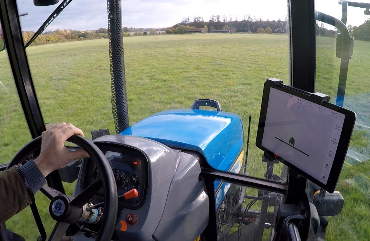
The GPS receiver is mounted on the bonnet above the steering axle, which is the most responsive point and as the nose of the tractor will travel off course much sooner than above the cab, the lightbar signals to the driver that he is going off course – it can also be followed on tablet or phone.
Read more:
- Digital office: Farmers' paperless business management app
- Precision farming: New software features from Topcon
- JD's new Starfire 7000 makes it an easy precision decision
Mr Keene added: "Most of our customers are grassland or mixed farmers. The system is mainly used for the likes of fertiliser spreading, spraying, mowing hay and silage, overseeding and cultivation work."
It is easy to set up. Once you have the free downloadable app, the onTrak device is fitted to the bonnet of the tractor using inbuilt magnets (or to adhesive magnet discs for fibreglass bonnets). Pairing with the app occurs automatically.
Users can then set the implement width using the simple user interface, program an AB line (just like all other GPS systems the AB line is programmed against the long edge of a field to which the driver wishes to remain parallel – and then follow the lightbar guidance when working across the field and use the screen display to help navigate onto the next line at the headland.
Features include field boundary mapping and area measurement, coverage recording and area measurement and speed display. It is also possible to overlay work on satellite imagery and to have visible section control (although this is currently for Android only).


Comments: Our rules
We want our comments to be a lively and valuable part of our community - a place where readers can debate and engage with the most important local issues. The ability to comment on our stories is a privilege, not a right, however, and that privilege may be withdrawn if it is abused or misused.
Please report any comments that break our rules.
Read the rules here