

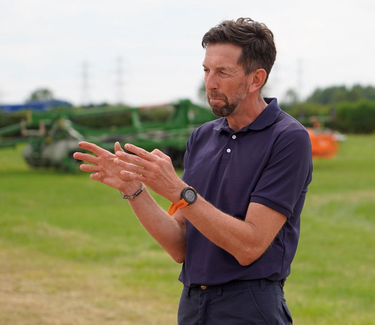
Combining satellite technology with precision machinery, has enabled cereal grower, Pat Thornton, to reap the rewards of better crop uniformity and yield, by optimising inputs usage and tracking disease on his farm in Doncaster.
He runs Low Melwood Farm, in Owston Ferry, in partnership with his father. The 150ha operation grows oilseed rape, winter wheat, spring barley and spring beans. Over the past season, he has been using digital platform xarvio Field Manager, as part of a field-scale trial with BASF, to identify historical productivity trends dating back up to 15 years and in-season field variation on his farm, which has allowed him to alter and target his inputs more precisely.
This software was launched in 2020 as a handy tool for growers and agronomists to improve collection and utilisation of data through satellite imagery, to help inform decisions throughout the season.
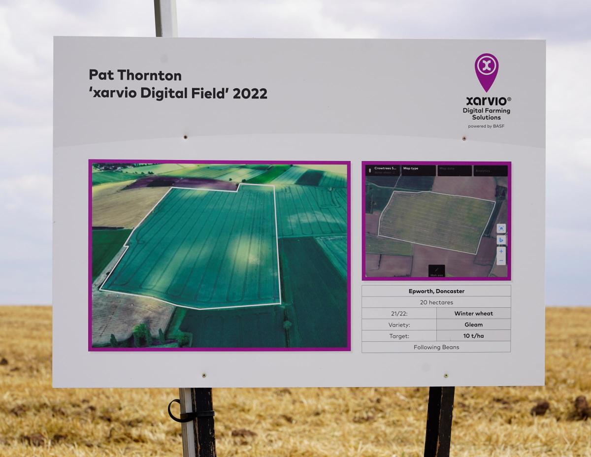
Growers can use the tool to access historical biomass maps, called PowerZone maps, which identify high and low performing field-zones, based on satellite data. In the summer of 2021, using these maps, Pat found that there was a fair amount of variation between his crops and was able to manipulate his seeding rates to improve uniformity in the field.
He explained that he was able to use the digital platform to identify historically less productive areas and then apply more seed in those targeted areas. “It is not low hanging fruit for a farm of our size to embrace this technology, it does come at a price, but when you have PowerZones that have 15 years of data you can access, there is a value to that and I was really surprised how much data was on there,” he said.
“We have also been able to use the latest in-season satellite images to target nitrogen rates to even out fields in the early spring. We were able to create application maps for our spreader, so thinner areas received a higher rate of 60kg per ha of N and thicker areas were reduced to 40kg per ha.”
He explained that he does not see the technology as a way of using less, or more inputs, but optimising the best use of what they have using data shown from satellite images. Pat has partnered Amazone precision machinery alongside xarvio Field Manager to get the most out of his seed, fertiliser and crop protection.
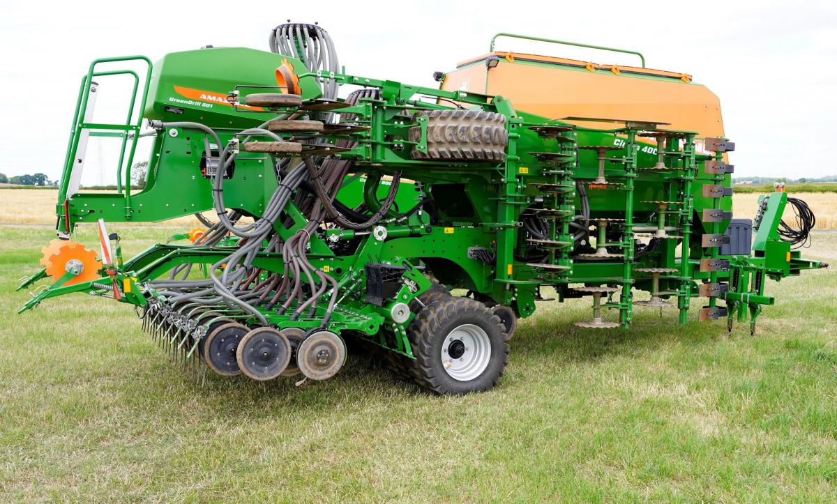
Amazone has a range of crop establishment and crop care equipment and have been providing seeding, spreading and spraying equipment which can be loaded with a prescription map to carry out a designated task, using information from the xarvio app.
For this project, the Cayena tine seeder and Cirrus cultivator drill were used for crop establishment and then crop care was carried out using a ZA-TS 3200 Profis Tronic spreader and Pantera 4504 self-propelled sprayer.
Managing director from Amazone, Simon Brown, explained that technology was going to prove ‘vital to keeping farming viable’. He said: “We can see obvious added value for farmers when you look at potential overlap savings: chemical savings; reduction in fertiliser usage; making the best use of seed by targeting zones and in the next year or two, we will get ever smaller zones.
"That's how we will probably keep some active ingredients going, because we're obviously only putting them where they need to be. Everything that we do is effectively working towards these smaller zones, with more control of what's going on.”
By altering seeding rates in August, 2021, Pat was able to see improved biomass consistency across his field by May the following year. He was then able to apply this targeted input approach to his fungicide programme.
Read more: Brian Henderson's Arable Matters: Fun and games at harvest…
xarvio implementation lead, Luke Pollard, explained: “We discussed how to target Revystar XE for Pat’s T2 application, using the latest satellite images, to produce an application map for the sprayer. We maintained the average use at 1.25 litres per ha, but we varied from 1-litre in the thinner areas up to 1.5 litres where there was more biomass and more green leaf area.”
Luke added that using a new piece of hardware called xarvio Connect – which physically connects to the terminal within the machinery – growers can wirelessly ping data backwards and forwards from the system to the terminal. “This allows a grower to, for example, send an application map for liquid fertiliser or crop protection to the sprayer terminal wirelessly,” he said.
Another tool recently added to the set-up was the 'field notes' feature, which allows growers to use GPS location on their phone to pin the location of a particular part of their farm and log any information or photos to monitor how fields are progressing. Pat said used this to help map black-grass which allowed him to go back to the precise location to treat it.
“It is a useful tool to have in your pocket when out walking the fields. I make notes, monitor disease risk and growth stage. It has brought an additional level of information and insight to help me make decisions on-farm,” he added.
The app can create management zones for biodiversity measures, targeting low performing and highly suitable field zones. Luke explained that using a biodiversity planner, growers could pinpoint less productive areas and assess suitability for a range of environmental management options and integrate those insights with seeding, nutrition, and crop protection maps.
“We have been working alongside The UK Centre for Ecology and Hydrology to look at how we can incorporate biodiversity maps in our app, to assess the most suitable zones for introducing biodiversity measures," he pointed out.
"They have done lots of research in terms of understanding which different factors on the field such as altitude, latitude, location of water sources, hedgerows, trees, etc and how all these have an impact on where is the most suitable area for example, for a pollinator habitat, or to drill some nectar mix or wildflowers.”
Growers can automatically exclude zones from their maps, for example for drilling, where they are about to plant nectar mixes. “I've been in this game long enough to know that we've been able to create many pretty maps for many years, but now a grower my size can actually utilise them,” he said.
“It is not information overload, and it comes back to the profitability and efficiency of this farm and it is making an impact. We can all walk and look at our farms and assess them to an extent, but having a tool like this gives you the ability to back up your decision-making process,” Pat concluded.


Comments: Our rules
We want our comments to be a lively and valuable part of our community - a place where readers can debate and engage with the most important local issues. The ability to comment on our stories is a privilege, not a right, however, and that privilege may be withdrawn if it is abused or misused.
Please report any comments that break our rules.
Read the rules here